Friday 12 / June / 2026
Muscat: Within the joint cooperation and efforts to combat flood risks, Muscat Governorate arranged a coordinating meeting with specialists from the Ministry of Agriculture, Fisheries and Water Resources to review the Ministry’s visions regarding the consultancy services project as visual presentations to update and prepare flood risks maps.
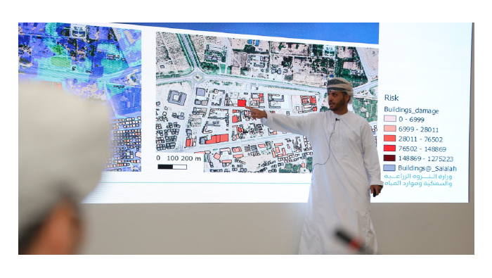
This meeting was attended by the Governorate and Muscat Municipality officials, a number of their Excellencies members of the Shura Council and the Municipal Council, the governorate’s Walis. During the meeting, Dr Mahmoud bin Mohammed Al Mamari conducted a comprehensive visual presentation, including the project’s purposes, stages, methodology and samples of its expected outputs.
According to Al Mamari, this project is based on three primary purposes. They include mapping and identifying flood risks’ areas, developing flood risk management and associated emergency plans, and preparing a comprehensive flood risk evaluation guide.
First, analysing rainfall and surface flow data. Second, designing detailed flood risks maps. Finally, developing risks and emergencies management plans. This project aims to implement protective strategies for the most exposed regions through designing plans that evaluate the flooding risk’s degree, he noted. These plans consist of implementing protective establishments, identifying evacuation and sheltering points, and submitting the required recommendations to the concerned entities. All these outputs will be summarised in a report entitled ‘Flood Risks Evaluation Guidebook’.
This project was officially initiated a year ago and is expected to be accomplished by 2026. It currently has reached 54% in Muscat, Dhofar and Musandam Governorates.